Advertisement

We need your help now

Support from readers like you keeps The Journal open.

You are visiting us because we have something you value. Independent, unbiased news that tells the truth. Advertising revenue goes some way to support our mission, but this year it has not been enough.

If you've seen value in our reporting, please contribute what you can, so we can continue to produce accurate and meaningful journalism. For everyone who needs it.
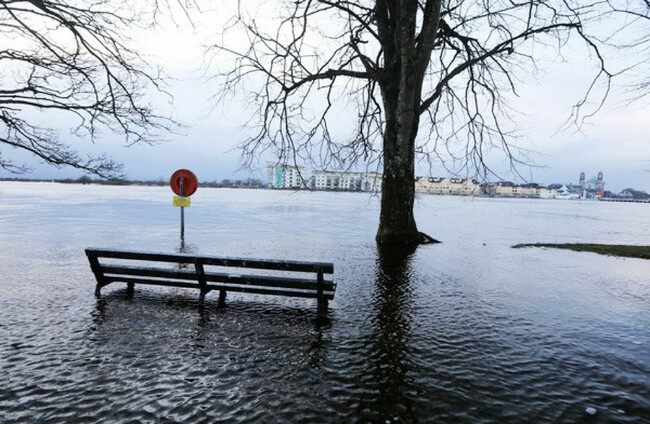
Fooding along the River Shannon in Athlone, February 2020 Eamonn Farrell/RollingNews.ie

'Singing from the same climate hymn sheet': Met Éireann to level playing field of Irish data

A new project is trying to bring existing work on climate data by other organisations under one roof.

A NEW PROJECT to standardise certain climate projections and services will aim to help sectors to start “singing from the same climate hymn sheet” by creating clearer access to information. 

Instead of disparate groups putting together various resources – for example, a flood map – with no common framework, Met Éireann is to act as a coordinator on climate information to try to standardise how climate services are provided.

It’s hoped that housing construction, roadworks, agriculture, water supply and other industries will benefit from being able to access shared information about the climate.

Cabinet green-lit the National Framework for Climate Services (NFCS) in June, which is trying to bring existing work on climate data by other organisations under one roof.

It comes under the remit of a new Climate Services Division at Met Éireann led by climatologist Keith Lambkin.

Speaking to The Journal, Lambkin said that the work is necessary to meet the massive increase in demand over recent years for reliable climate information.

Previously, parties interested in climate data were largely limited to insurance, construction, and climate scientists themselves – but now “everybody, in every sector, in every walk of life” has a stake, he said.

“They all have actions, they all have decisions to make… very, very quickly, it’s gone from 100 years of the status quo to within a handful of years becoming of huge interest and importance to every sector of society, whether they realise it or not.

“If all these different sectors have to take actions, to do these actions they have to make decisions, and in order to make decisions, you need information. The whole demand for climate information effectively changed overnight.”

The new climate division, as well as continuing analysis work on climate data already done by Met Éireann, will be trying to improve climate communication by targeting it in different ways to specialists, policymakers, and those affected by changes.

A core project will be the new services framework that is seeking to take past and future climate data and turn it into “usable, actionable information”.

“The climate service is a tailored product to give specific climate information in a way that that particular decision maker can use it, whether that’s to build roads or a million other questions that sectors would have to spend money on,” Lamkin said.

What we’ve done in this country is that any time we’ve needed a flood map or a landslide susceptibility map or some kind of specialised roadmap, a project was typically commissioned, and that project used whatever climate data they can get their hands on.

“When it comes to climate projections, there’s an enormous amount of climate projections that cover Ireland from different models and different groups.

“What was happening was people were building their climate service to meet their needs but the different groups around the country were using different underlying climate data to build their products, which was fine for their reasons and answered their questions but it made it really, really difficult to compare these products across different sectors.

“What could potentially happen is that somebody in agriculture could create a rainfall index product that they needed for crops they’re going to grow in the future and somebody else in the water sector may try to produce a similar index but get a different answer because they’re using different data.”

That disparity makes it difficult for planning climate adaptation – that is, how to safeguard people, places and sectors against the consequences of the climate crisis.

The NFCS is creating a national standard climate projection dataset that will be available for all sectors to use.

Those will mean sectors are “all singing from the same climate hymn sheet, because at the moment, we’re not”.

Additionally, it will produce national climate services “to a standard that’s easily ingested into everyone else’s system”.

“So if a local authority somewhere in the country needed access for planning purposes and they don’t want to build capital infrastructure in an area that’s prone to landslides or flooding or coastal erosion, they’ll be able to combine all these maps [on the various risks] because they’re done in a standardised way,” Lamkin explained.

One such service is a climate parameter called a driving rain index, which shows average annual rainfall and windspeed.

Different areas around the country are exposed to different levels of rain and wind. For the housing sector, that means houses should be built differently depending their location to withstand the weather in that region.

“People who are in charge of setting the standards for building houses need to know how that driving rain index is going to change in the future because houses they build now may be around for 100 years, so they have to make sure they’re climate-proof,” Lambkin said.

“We would work with them to build specialised climate services, specialised climate maps, and in the past, we would have given it to them and they would have used the data and it would have happened in the background.

What’s going to happen now under the new national framework is that we still build that but we also see while we’re building it is it useful to any other sector. They might have tweaks or different needs.

“We still focus with the main stakeholder but we branch out to the other sectors as well and see are there tweaks we can make to it to make it a bit more of a universal product and then we make that universal product available online with guidance and freely available, and so on, so forth.

“That’s available then not just to the sector but to academics who want to do more research, so it’s enabling far more access to the latest state-of-the-art climate information.”

Other examples include bridges, which will need to be able to withstand the pressures of extreme weather events from heavy snow to intense heat; drainage systems; and construction of buildings that would be vulnerable to fires, such as nursing homes and hospitals.

Readers like you are keeping these stories free for everyone...
A mix of advertising and supporting contributions helps keep paywalls away from valuable information like this article. Over 5,000 readers like you have already stepped up and support us with a monthly payment or a once-off donation.

Close
13 Comments
This is YOUR comments community. Stay civil, stay constructive, stay on topic. Please familiarise yourself with our comments policy here before taking part.
Leave a Comment
    Submit a report
    Please help us understand how this comment violates our community guidelines.
    Thank you for the feedback
    Your feedback has been sent to our team for review.

    Leave a commentcancel

     
    JournalTv
    News in 60 seconds