Advertisement

We need your help now

Support from readers like you keeps The Journal open.

You are visiting us because we have something you value. Independent, unbiased news that tells the truth. Advertising revenue goes some way to support our mission, but this year it has not been enough.

If you've seen value in our reporting, please contribute what you can, so we can continue to produce accurate and meaningful journalism. For everyone who needs it.
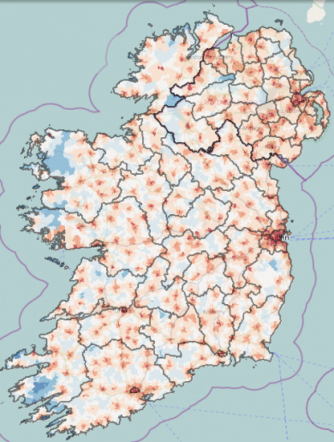
The AIRO map displays various data - like, for example, how far you are from a secondary school.

Handy new online map shows how far you are from a hospital

A map produced by an observatory based at NUI Maynooth will also show distribution of train stations or schools.

A RESEARCH OBSERVATORY based at NUI Maynooth have unveiled a new online mapping tool that aims to show exactly how some parts of Ireland are covered by hospitals or schools.

The accessibility map, produced by the All-Island Research Observatory, highlights areas based on their proximity to facilities like hospitals, primary schools and secondary schools.

It also allows users to see what parts of the country are best served by airports, rail stations and even A&E wards.

The idea of the project is to underline how some parts of the country are relatively more deprived than others, in terms of coverage of particular services, with particular emphasis on how this changes depending on whether someone lives in the Republic or the North.

The map was launched at the International Centre for Local and Regional Development conference in Dundalk during the week.

The creators believe that the data offered by the tool gives “a unique insight into the cross-border distribution of facilities and services and is also an important step forward in the understanding of the spatial distribution of deprivation on an all-island basis.”

Among the data that can be gleaned from the map is that average travel times to services in Northern Ireland – and in particular the travelling time to medical care – are lower than those in the Republic.

The average commuting time to a 24-hour A&E ward for a person living in Northern Ireland is 16 minutes, while in the Republic that time is 21 minutes – though it can rise to over 60 minutes on the country’s western fringes.

Roscommon – which lost its 24-hour emergency department last year – has the longest average wait, with an average travel time of 40 minutes to a 24-hour unit.

The map can be accessed on the AIRO website.

Readers like you are keeping these stories free for everyone...
A mix of advertising and supporting contributions helps keep paywalls away from valuable information like this article. Over 5,000 readers like you have already stepped up and support us with a monthly payment or a once-off donation.

Close
15 Comments
    Submit a report
    Please help us understand how this comment violates our community guidelines.
    Thank you for the feedback
    Your feedback has been sent to our team for review.
    JournalTv
    News in 60 seconds