Sign in. It’s quick, free and it’s up to you.
An account is an optional way to support the work we do. Find out more.
Sign in. It’s quick, free and it’s up to you.
An account is an optional way to support the work we do. Find out more.

LAST UPDATE | 1 hr ago
THE PUBLIC HAS been advised to avoid unnecessary travel in counties where wind warnings are in place.
The public are being urged to take caution, especially when using the roads, and prepare for potential impacts like flooding and fallen trees.
Met Éireann has issued multiple weather warnings for throughout the weekend:
The National Directorate for Fire and Emergency Management (NDFEM) group met today to discuss the potential impacts of Storm Boelo.
It said in a statement this afternoon that heavy rainfall when the ground is saturated and river levels are already elevated means there’s a risk of flooding, particularly in the west and southwest.
“Small upland and urban rivers will respond fastest, and larger rivers may keep rising even after rain eases,” the group said.
Storm Boelo is the second named storm of this winter’s storm season, following swiftly behind Storm Austen which hit late on Thursday and into Friday morning.
Keith Leonard, the chair of the NDFEM, said: “While Storm Austen has not resulted in any major impacts, the arrival of Storm Boelo so quickly afterwards means we cannot be complacent.
“We are particularly concerned about the very strong winds anticipated in coastal regions from Galway up to Donegal.
“The clearest public safety advice for people in those counties under an Orange wind warning is to avoid all unnecessary travel.”
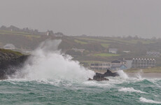
#StormBoelo shore road Belmullet at high tide @barrabest @CarlowWeather @DonegalWeatherC @metoffice @rte https://t.co/qYqjwwHO8i
— johns (@johnhest2014) October 24, 2026
In the five counties covered by the Status Orange wind warning starting this afternoon, Met Éireann expects there to be gale force westerly winds with severe and damaging gusts.
The forecaster has warned there could be damage to structures that are already weak, as well as to power lines.
So far there have been some outages. As of 7pm, there were over 18,000 properties without power.
To get real-time information on an outage in your area, check the ESB website.
The ESB stressed the dangers posed by fallen live wires and is advising the public and the emergency services to stay away from them. If you see fallen wires, you should report it immediately by calling 1800 372 999.
Dublin Airport said that, as of 4pm, nine outbound flights and 10 inbound flights have been cancelled by airlines because of weather conditions.
Six inbound flights performed “go-arounds”, it said in a post on X.
“Five of these landed on the second attempt, with the other diverting to another airport before returning a short time later.”
“Passengers should travel to the airport as normal – 2 hours before short-haul, 3 hours before long-haul – and keep in direct contact with their airline for latest updates regarding the status of their flight.”

Coastal flooding is possible and there will likely be “very difficult travelling conditions and dangerous conditions at sea”, Met Éireann said.
Fallen trees, public transport delays, large coastal waves and loose objects coming dislodged are also risks.
A Status Red marine warning has been issued for the area from Rossan Point to Bloody Foreland to Fair Head. Met Éireann warned of a “violent” marine storm which will reach force 11 at times.
The warning is in place until 6am on Sunday.
In Northern Ireland, all six counties are currently covered by a Status Yellow wind warning.
The national emergency management group gave further advice to the public on how to stay safe.

To embed this post, copy the code below on your site















have your say